
Lunar exploration has always held a strange position in the history of exploration. For all of human history, people have been staring up at the Moon, and for centuries astronomer used telescopes to study the lunar surface. The telescopic surveying and mapping of the Moon by astronomers can (and should, I think) be considered a form of exploration. From this perspective, the Moon had been thoroughly explored far before the dawn of the Space Age. But on the other hand, because of the nature of the Moon’s orbit, the Moon also possessed some of the most mysterious and inaccessible terrain that ever taunted exploration-minded humans.
The Moon is tidally locked, meaning that only one side of the Moon ever faces the Earth. And so for all those millennia of Moon-gazing, there was an entire half of our natural satellite that no human had ever seen before. We would only get our first look at the end of the 1950s, and it would take even longer for us to complete a full map of the Moon. Here is a visual history of how we did it, designed to guide you through the process, even if you aren’t yet familiar with any lunar features.
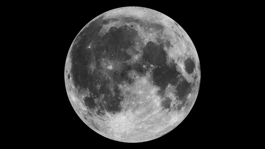
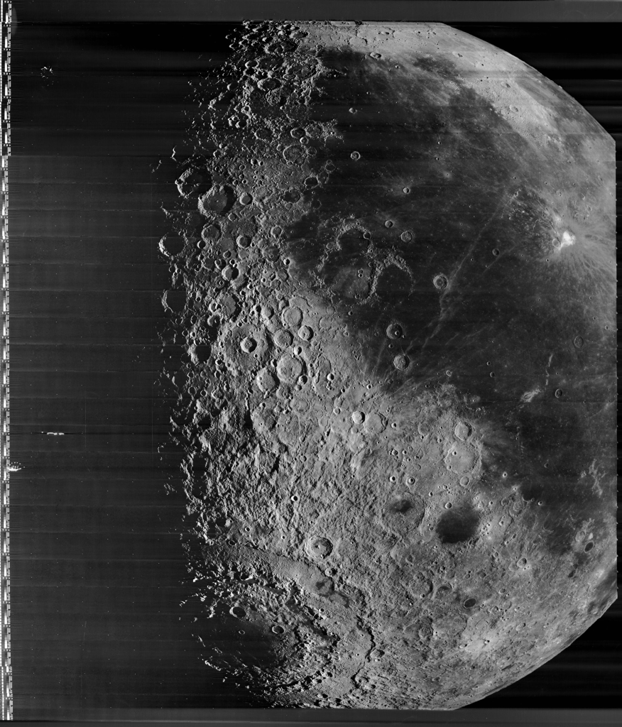
First, let’s look at the near side of the Moon. The dark parts are the maria, Latin for “seas.” The brighter parts are, generally, called the highlands.
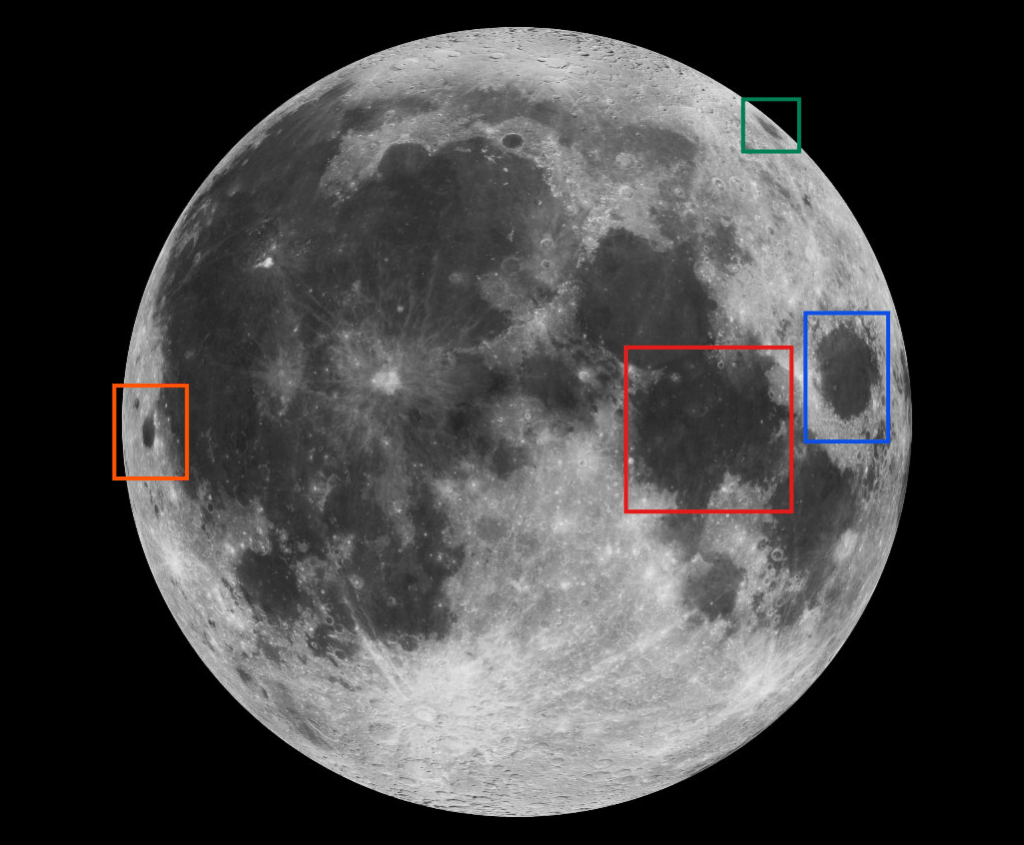
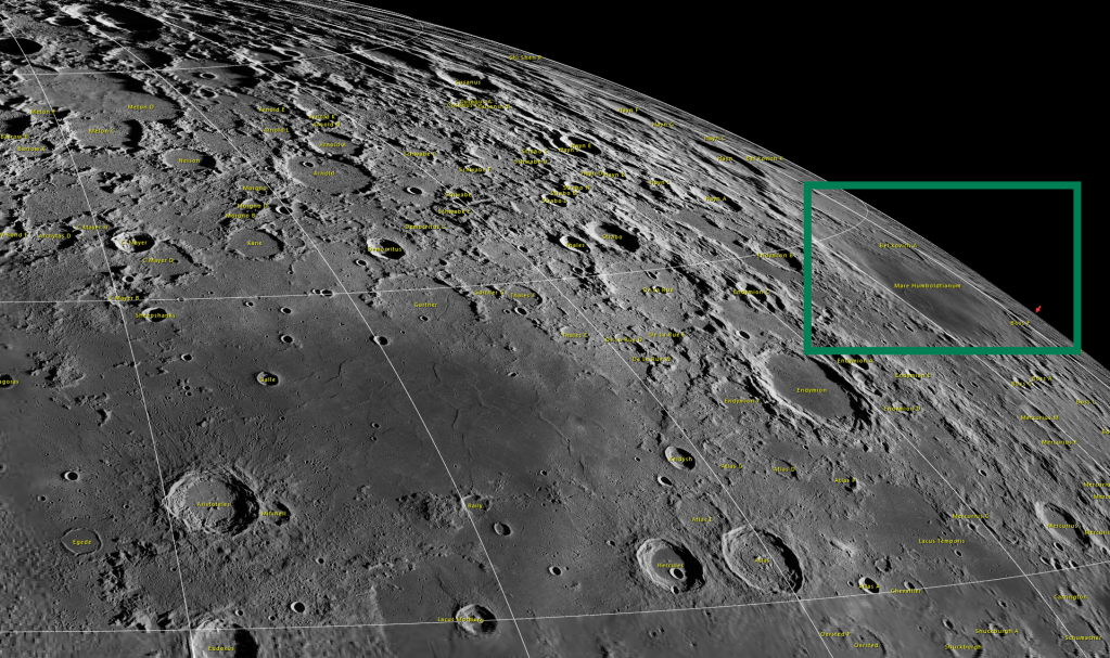
The maria provide helpful landmarks for understanding how the far side of the Moon was revealed, and I have highlighted a few helpful maria below. In red you can see the Sea of Tranquility, probably the most famous mare, since that’s where Apollo 11 landed. But the other ones I have marked will be the most helpful landmarks for this history. We will especially be tracking Grimaldi, really a crater on the western limb (edge) of the Moon with a mare floor. Over on the eastern limb, highlighted in green, is the Mare Humboldtianum. I’ve highlighted Mare Crisium in blue, since it is large and distinctive. But mainly keep your eye on Grimaldi and Humboldtianum.
Oddly, even though the moon is tidally locked, we have been able to see small portions of the far side, due to a wobbling motion called lunar libration. You can see libration happening in the animation below. You might be able to notice that Humboldtianum actually disappears over the limb at certain times. Because of libration, we have actually been able to see more than fifty percent of the lunar surface for a long time. In the 17th century, astronomers began using telescopes to study the extent of libration, and to extend lunar maps slightly.1

William Gilbert and Galileo were some of the first astronomers to detect and measure libration, and to attempt mapping the Moon in detail.2 Over time, astronomers began depicting the effects of libration on their maps, which can be seen very well in Johannes Hevelius‘ 1647 map from his Selenographia. The slivers on the northern and southern edges of the map show which areas come in and out of view through libration, and you can see that the effect is slightly more pronounced near the poles. You might even be able to find Humboldtianum on this map.
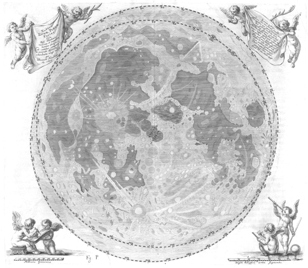
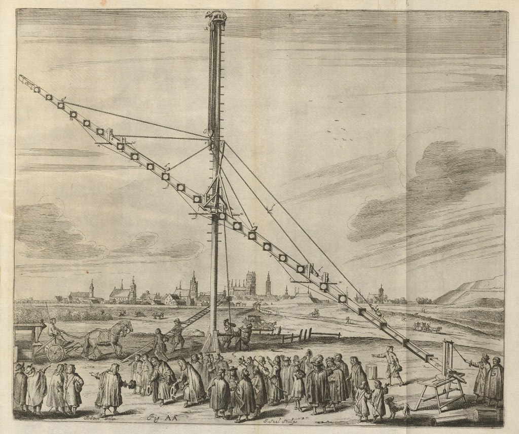
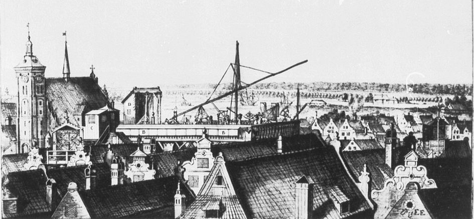
Hevelius was using some traditional astronomical measuring devices, but he was also using telescopes of his own construction.3
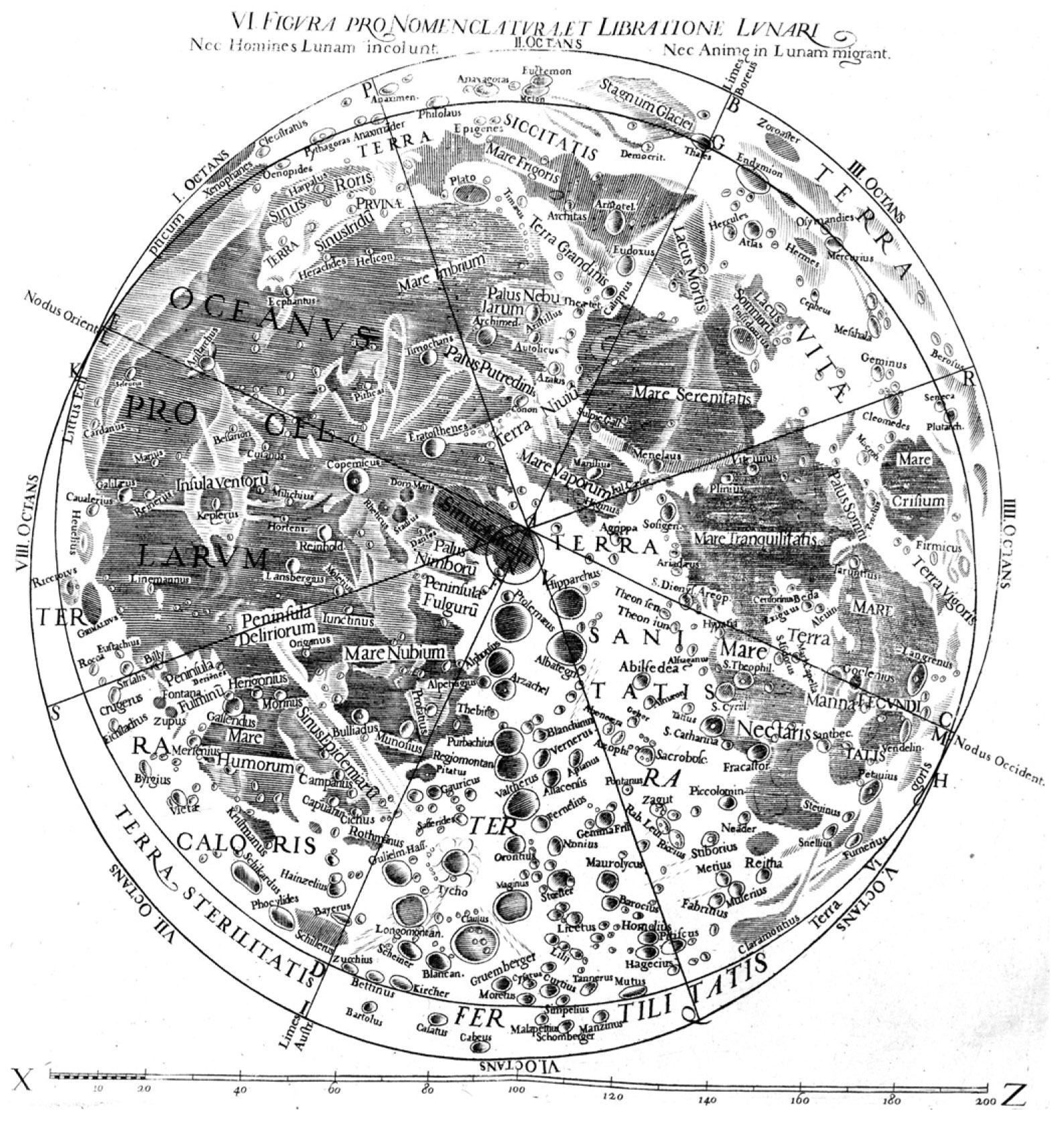
We also see libration depicted on the map below, made by Giovanni Battista Riccioli in collaboration with Francesco Maria Grimaldi in 1651. Riccioli’s naming scheme was one of the most influential, and our maps today retain many of his names. You can see Mare Tranquillitatus and Mare Crisium on this map, for example. You can also see that Riccioli named the crater Grimaldi after his illustrator. He also named a nearby crater after himself, and yet another in the vicinity after Hevelius. Humboldtianum, however, is named Zoroaster on Riccioli’s map.
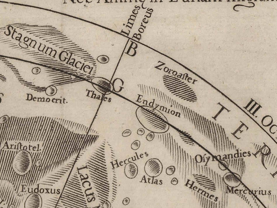
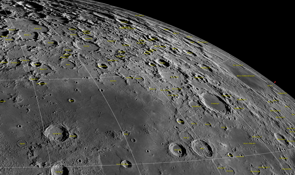
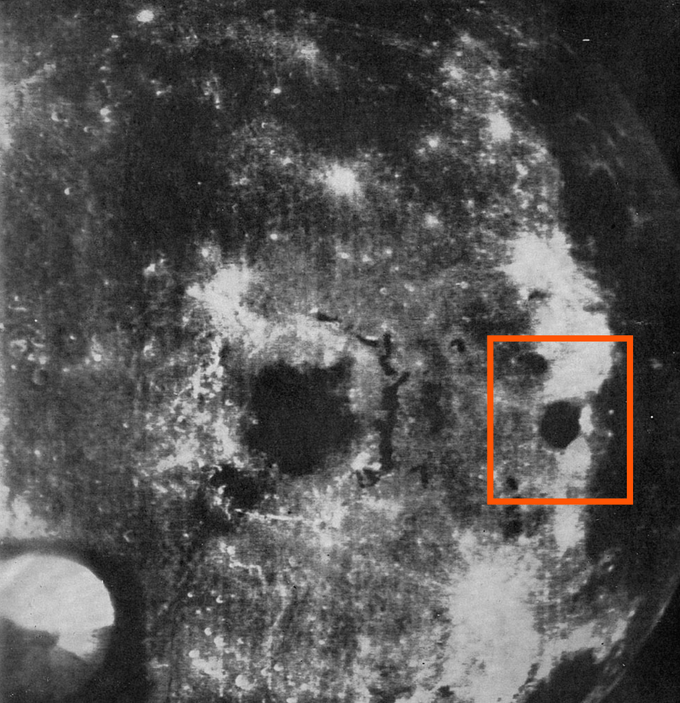
Below, you can see the effects of libration on the visibility of Zoroaster/Humboldtianum. It’s helpful to note the positions of Aristotle, Hercules, Atlas, and Endymion. They can help you orient yourself around the northeastern limb.
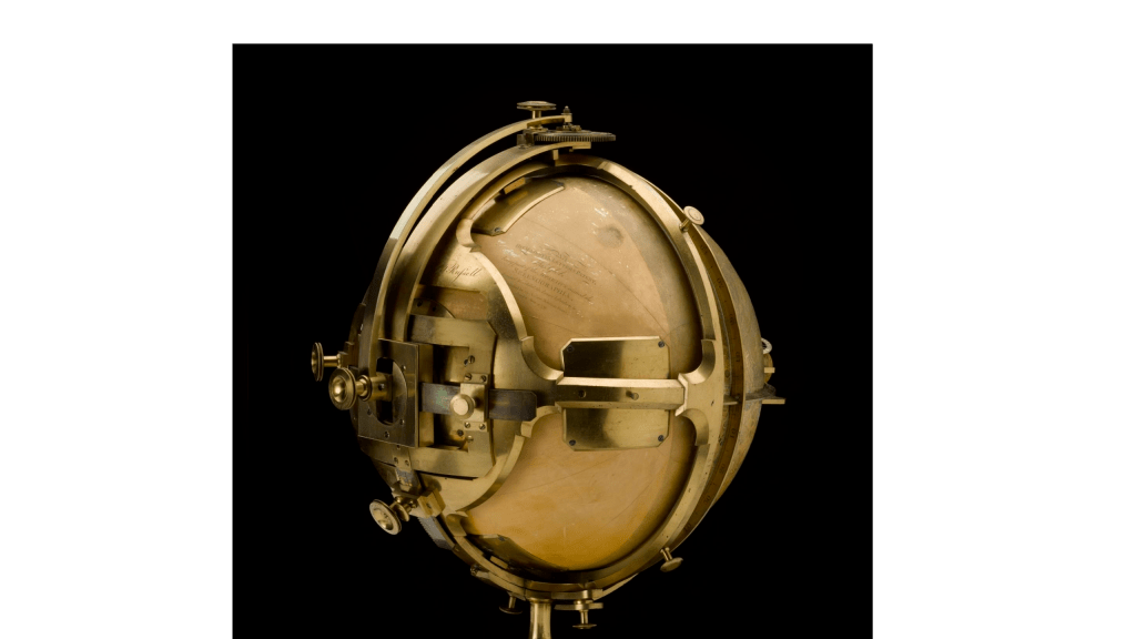
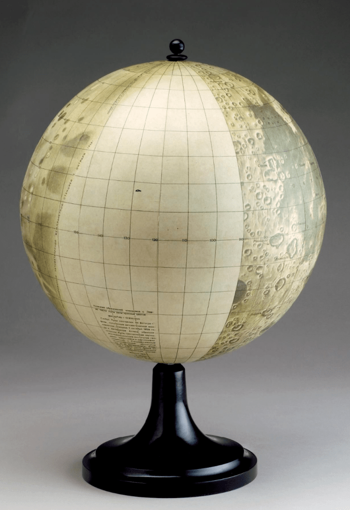
This view was the one that astronomers had for the next several centuries. Better telescopes allowed observers to add a little more detail near the limbs, but observing features there would always prove extremely difficult. For the time being, the far side of the Moon would remain obscured. We can get a decent idea of the extent of our knowledge using John Russell’s Selenographia, an amazing lunar globe from 1797.4
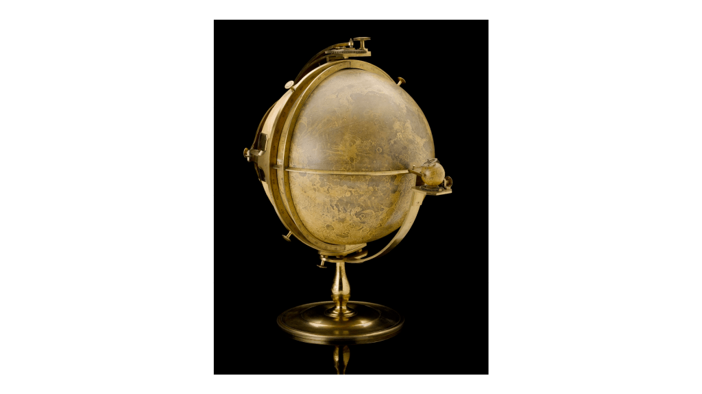
On the back of the globe, you can see the blank spots on our map. You can also see clever mechanisms Russell devised to display the movement of the Moon caused by libration.
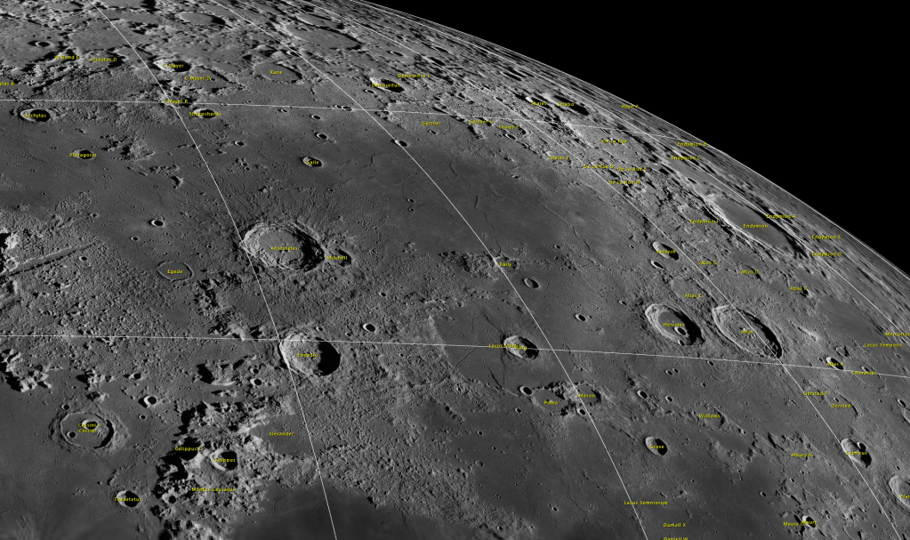
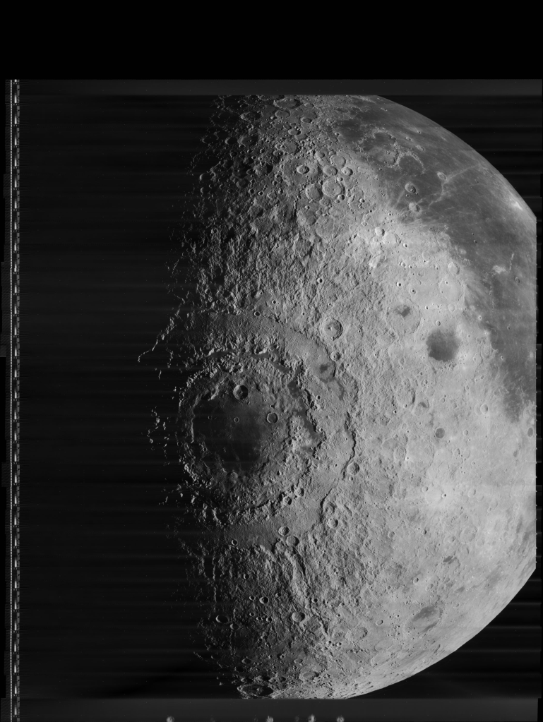
If we take a closer look at the western limb, we can see Grimaldi clearly, with Riccioli and Hevelius nearby. We can also see that Russell has filled in a lot of the area sometimes hidden through libration to the west of that area. This is where his map became more difficult to align with real features on the lunar surface. This is partly because that area is heavily cratered, and gives us a tantalizing glimpse at one of the largest and most complex surface features on the Moon.
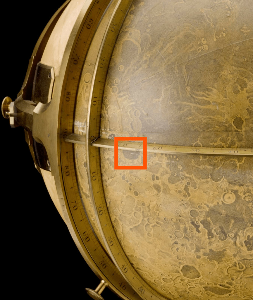
If we look really closely at the western limb as libration brings more westward features into view, we see what looks like some layered mountains, interspersed with dark surfaces. Russell looks to be depicting some of these mountains, and the darker areas between them. These seemed to go unnoticed by other astronomers until the late nineteenth century, when Russell’s darker areas begin to appear on maps again. But there is another dark mare beyond those mountains, and in the early twentieth century, German astronomer Julius Franz gave it the name Mare Orientale.5
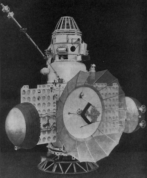
We wouldn’t be able to get a better look at the far side of the Moon until we invented a way to send cameras there. At the dawn of the Space Age, rockets gave us the ability to do just that. In 1959, Soviet engineers created a series of robotic probes, and launched them toward the Moon. One of these managed a lunar flyby, and was named Luna 3. Engineers equipped Luna 3 with a film camera, capable of developing the exposed film, scanning the images, and transmitting them back to Earth by radio. For a fantastic look at the technology involved here, and some of the images, check out Don P. Mitchell’s website. You should also read Sven Grahn’s work on how Jodrell Bank radio observatory in England intercepted the images as they returned.


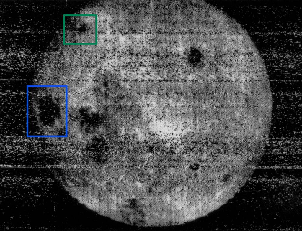
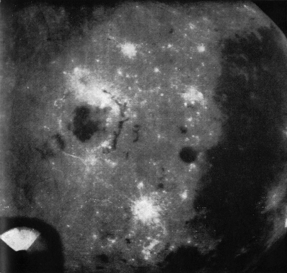
In October of 1959, in a cramped room on the Crimean Peninsula, Russian engineers Boris Chertok, Sergei Korolev, and colleagues watched as images materialized slowly on heat-sensitive paper.6 Here is the first image we have of the far side of the Moon:

It is not the highest quality, but it is fairly amazing that it was possible at all in 1959, given the early state of the technology. Below, I’ve highlighted our landmark maria for reference–we’re seeing around the eastern limb. While distinct craters are hard to make out, we can easily see some new maria. The ones to the right and south of Mare Crisium are Mare Smythii and Mare Marignis (we had some glimpses of them on the western limb before Luna). But way out there on the right hand side of the image are two entirely new, entirely distinctive maria. The large one in the north was named Mare Moscoviense. The one in the south with the peak in the middle is the crater Tsiolkovskiy, named for the pioneering Russian rocket scientist.
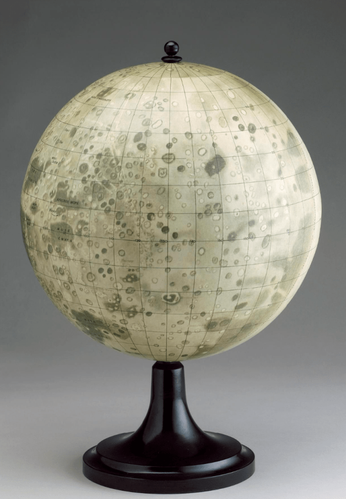
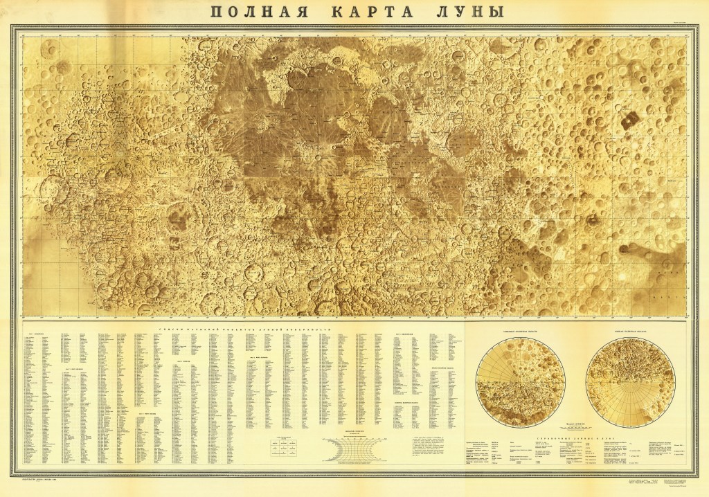
Russian astronomer Yuri Naumovich Lipsky led the effort to interpret the images and begin a map of the lunar far side. His efforts led to the following maps:
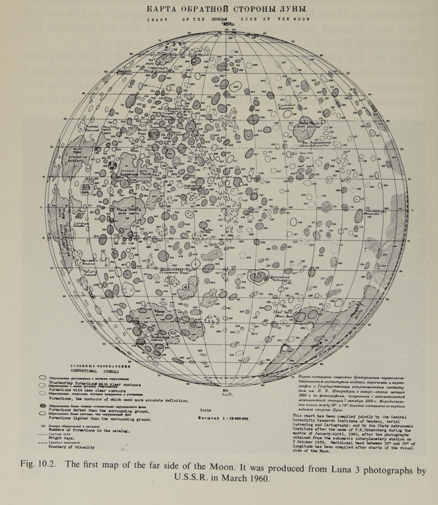
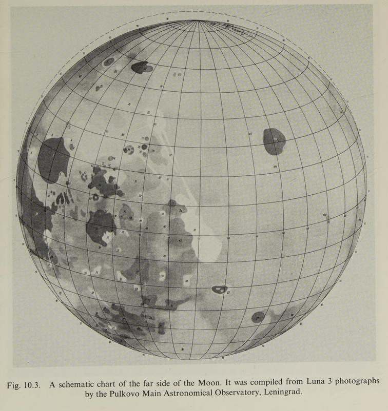
This globe was produced, which is a fantastic glimpse at how much of the surface Luna 3 managed to add to our map. But you can clearly see the massive blank spot, and Mare Orientale remains frustratingly in mystery.
It would remain that way until 1965, when Soviet engineers sent another robotic spacecraft passed the Moon. Zond 3, which may have been destined for Mars, flew by the Moon equipped with another film-based system, and captured a handful of images. To see more about the technical details of Zond 3 and its flight, you should check out Andrew LePage’s website. And once again, Don P. Mitchell has an incredible collection of Soviet lunar photographs.
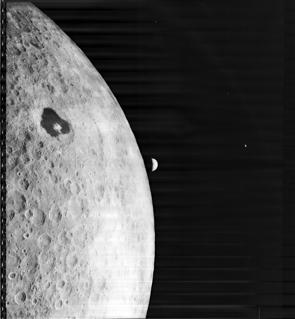
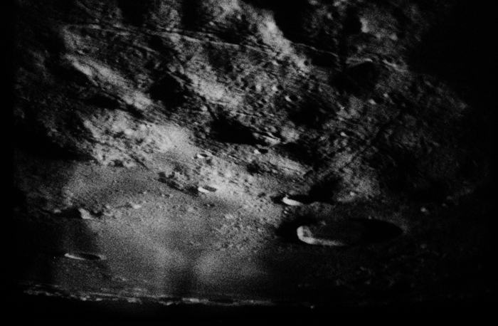
And, for the first time, we see Mare Orientale in its entirety:
Here’s a reminder of where we are, to orient ourselves. Zond 3 is giving us a glimpse over the western limb, past Grimaldi:
And once again, Lipsky went to work putting all this new data on the map. You should be able to see Crisium, Humboldtianum, and Grimaldi for reference. We can now see Orientale, Muscioviense, and Tsiolkovskiy in their proper positions. But notice, there are still blank spots on the map.
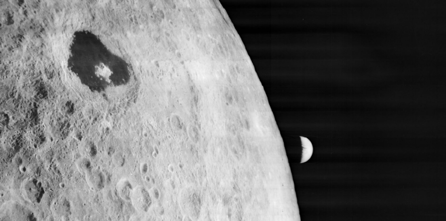
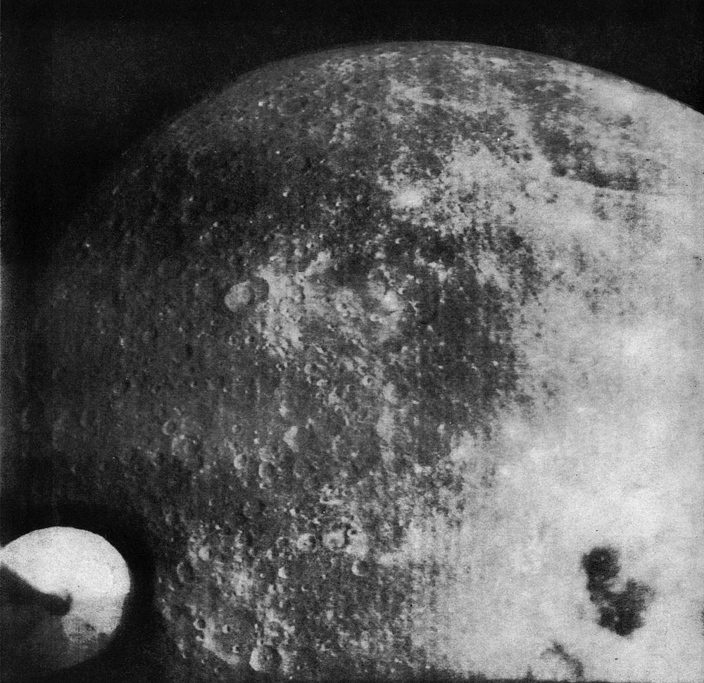
Then, in 1966 and 1967, NASA sent five robotic probes to the Moon: the Lunar Orbiters. The Eastman Kodak company adapted camera systems they had designed for the CIA to the task of mapping the Moon in preparation for the Apollo program. The teams behind Lunar Orbiter took thousands of incredibly high resolution images of the lunar surface. The first several Lunar Orbiters were mainly used to scout out landing sites for Apollo on the near side. But even on Lunar Orbiter I, they managed to capture some images of the far side. One of them was this shot, with Tsilkovskiy sitting in the foreground of the first “Earthrise” image ever captured.
What made Lunar Orbiter distinct from the Soviet efforts was not only the number of images, but the level of detail that each image contained. Two lenses allowed the simultaneous capture of both medium-resolution and high resolution images, like this one showing the central peak of Tsiolkovsky and its inner walls.
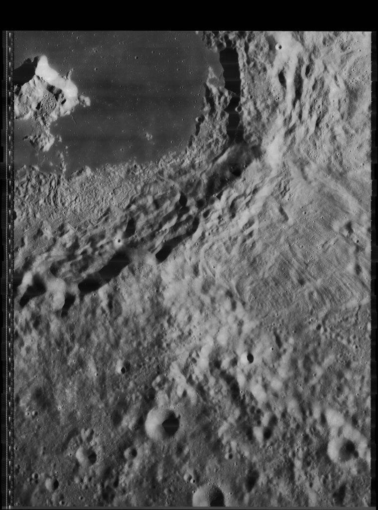
On Lunar Orbiter IV and V, scientists got the opportunity to play a more direct role in target selection. In the shot below from Lunar Orbiter IV, you can see Grimaldi, and down there near the edge, coming into full view: Mare Orientale. Just a few shot later…
Mare Orientale.
Between all the Lunar Orbiters, we gained imagery of 99 percent of the lunar surface. This allowed cartographers to create a fully detailed map of the lunar far side.7

Apollo astronauts orbiting around the Moon would add to our imagery and understanding of the far side, as would more Soviet probes. Later robotic probes would fill in the few remaining gaps, which were mainly near the poles. Over those years, our knowledge and understanding of the lunar surface would only continue to grow. For centuries, the far side of the Moon had been one large blank spot on a map. Then, in less than ten years, largely due to the hard work of engineers and scientists working with robotic probes, we filled in blank spots. We have become more fully acquainted with our Moon, but we still have more to learn.
Special note for posterity:
This post was written the day before the crew of Artemis II flew around the Moon. One reason for the focus on Mare Orientale in this history is a quirk in the history of direct observation of the lunar far side by astronauts. On all the Apollo missions, their orbits and the lighting conditions never allowed them to view Mare Orientale under sunlight. The closest they got was an image of Orientale under Earthsine on Apollo 17. Tomorrow, people will see Mare Orientale in fully glory for the first time.
- There are a lot of great histories of the early mapping of the Moon, but I won’t linger long on the details in this post. One of the most definitive is Ewen Whitaker’s Mapping and Naming of the Moon. There is also a good section on the topic in Mapping of the Moon: Past and Present by Zdeněk Kopal and Carder. Much of the information in this post comes from these sources. ↩︎
- Stephen Pumfrey argues Gilbert was definitively first: https://adsabs.harvard.edu/full/2011JHA….42..193P ↩︎
- Janet Vertesi takes a look at where Hevelius’ instruments fit into the technological culture of the time: https://www.jstor.org/stable/40731030 ↩︎
- The Linda Hall Library has a digital copy of Russell’s pamphlet, in which he describes the workings of the device: https://catalog.lindahall.org/permalink/01LINDAHALL_INST/1oon2h5/alma99455413405961 ↩︎
- Mare Orientale means “Eastern Sea,” which is confusing, considering it is on the western limb. The name was correct at the time Franz observed it–the directions changed in 1961. Ewen Whitaker and Richard Baum have a great history of Mare Orientale, which highlights the contributions of Russell, and explains the shift in directions. ↩︎
- See Boris Chertok’s Rockets and People, Volume II (PDF), translated by Asif Siddiqi. 519-538 ↩︎
- For more on Lunar Orbiter, you can find my master’s thesis on the about page, which focuses especially on the Kodak camera systems and the role of science in Lunar Orbiter. There is also NASA’s official history by Bruce Byers, and Farouk El-Baz’s The Moon as Viewed by Lunar Orbiter. The Lunar and Planetary Institute has an amazing page hosting images from Lunar Orbiter. ↩︎

.JPG)