Kodak’s “Pre-Invented” Lunar Orbiter Camera; or, The Fate of SAMOS Readout

Left: The Lunar Orbiter camera system sitting in the bottom half of the pressurized shell. Project Manager Cliff Nelson (left) stands with NASA/Langley team members Calvin Broome, Israel Taback, and Joe Mooreman. From NASA. Right: Lunar Orbiter frame 5017-M, showing artifacts from Kodak’s camera system. From NASA/LOIRP.

In 1966 and 1967, NASA sent five robotic spacecraft into orbit around the Moon. Constructed for the primary purpose of finding landing sites for Apollo, the Lunar Orbiters also enabled nearly comprehensive mapping of the Moon in stunning detail. The quantity and resolution of the photographs returned by Lunar Orbiter was unprecedented, thanks to a camera system built by the Eastman Kodak company of Rochester, New York. Their imaging system involved elaborate mechanisms to expose photographic film in orbit, develop the film onboard the spacecraft, and remotely transmit images back to Earth.

In February of 1967, the Rochester Times-Union published a story about how Kodak had “pre-invented” the Lunar Orbiter camera. Kodak director of R&D Arthur Simmons told the Times-Union that “no one walked in and asked us to develop a camera and film system to take closeup photos of the moon…Kodak has, for want of a better word, a ‘library,’ of hundreds of ‘conceptual ideas’ which we don’t advertise.”1 But the story of the camera’s “pre-invention” was more interesting than Simmons let on. When Kodak joined Boeing’s bid for the Lunar Orbiter in 1963, the camera system already existed. The company had originally developed it for the Air Force in the 1950s as a part of the highly classified satellite surveillance program called Weapons System 117L (WS-117L).

The nature of WS-117L and the clandestine origins of the Lunar Orbiter camera system were vaguely known by some at the time, but the full details were only revealed to the public through declassification decades later. This article won’t linger on the detailed technical specifications of the Lunar Orbiter cameras, but will instead focus on tracing the system’s development from conception to its adoption by NASA. It is the story of some of the first attempts by the United States to remotely transmit images from space, and how those same systems were adapted for lunar exploration.

WS-117L had roots in RAND studies of satellite surveillance concepts going back to 1946, and was the first major attempt to put those ideas into practice. The United States was hoping that satellites could be used to monitor the buildup of nuclear weapons and launch sites in the Soviet Union. In 1953, RAND Report 262 laid out in full the feasibility and utility of such systems, and by 1955 the Air Force began soliciting contractors for WS-117L. Eastman Kodak created camera systems for Lockheed’s bid, and the the Air Force awarded their contract in October of 1956.2

Timeline of the Advanced Reconnaissance System, or WS-117L, from a 1958 summary. From NRO (PDF).

Originally, RAND had primarily considered using television systems.3 “Near real time” imaging was considered by some to be the ideal form of satellite surveillance, so television was a logical choice. But in a declassified history of the program, Robert Perry explains that the goal of real time imaging quickly became contested within the Air Force–it was unclear whether the technology was ready to satisfy requirements, and the alternative film recovery systems showed clear feasibility and reliability early on. Some of these efforts were spun off from WS-117L into the Discoverer-CORONA program, which sent Kodak camera systems into orbit, and returned capsules of exposed film for aerial retrieval and processing back on Earth.4 Early on, however, a near real time system was very much a part of the plan. In their bid for WS-117L, Kodak created a remote transmission system that would fly in what became known as the SAMOS program.

Television systems were still in consideration early on, but there were clear technological limitations at the time, especially when it came to resolution. Kodak’s newly formed Apparatus and Optical Division settled on a system to develop film onboard the spacecraft and “readout” the images to receiving stations on Earth. Planners envisaged five cameras for SAMOS, the first three dedicated to testing Kodak’s readout system (the others testing advanced recovery stems). The E-1 camera would primarily be a technology demonstrator, while the E-2 and E-3 would test the ability for their system to take images at more functional resolutions. All used the same basic architecture.

A diagram showing the various SAMOS camera systems and their proposed capabilities. From NRO (PDF).

In a way, this camera system was in fact “pre-invented,” as it was mostly a clever assembly of existing technologies, many created by Kodak. The company had decades of experience in aerial photography going back to World War I. By the end of World War II, they had created advanced aerial films, compact film storage systems, and image motion compensation techniques. They had also worked on IR bomb sights and proximity sensing for the Navy, which would become useful for developing thermal control materials for the spacecraft.5

Illustrations from 1957 show a rough sketch of their plans for SAMOS readout. Kodak’s 70mm film would be exposed, processed, and stored before readout and transmission. Electronic signals received on the ground would be used to reconstruct the images.

An early diagram showing the SAMOS readout system without some of the key details. From NRO (PDF).

By 1958, planning documents started detailing two of the key technologies that ultimately made the readout system possible. One was what became known as Kodak “Bimat” film, labeled in the illustration below as “WEB.”6 This web was coated with gelatin containing the necessary processing chemicals, enabling “dry” processing. The web was pressed against the exposed film, developing and fixing the images before storage and transmission.7

Diagram from a 1959 Lockheed briefing on the SAMOS program, image is labeled September 1958. From NRO (PDF).

The origins of Bimat film are somewhat obscure in the public record. One Kodak-produced history suggests that the technology started as a laboratory investigation with amateur photography in mind, and was then applied to use in aerial photography.8 Considering the timeline, it was either a happy accident that this experiment matured just in time for WS-117L, or Kodak engineers started looking into the technique specifically in response to the challenges of film photography in space. 

A Lockheed development plan from March 1956 describes the processing system in vague terms, stating that it would “not differ significantly” from existing methodologies for “airborne rapid-processing,” and describing a notional “a roller-applicator type” system. It also lists “the handling of photographic chemicals” as one of the “major difficulties to be overcome.”9 The illustration from 1957 shows the onboard processing step without the “WEB,” a detail that only shows up in diagrams like the one above labeled 1958.10 Then, a patent for a “web processing method” was filed in August 1959 by Kodak researchers, presenting “a one-step method for substantially completely developing and fixing a photographic image…without immersion in photographic processing baths.”11 David McDowell, an engineer who joined up with Kodak in late 1956 and worked on both SAMOS and Lunar Orbiter, also remembers Bimat being developed specifically for the project. “Bimat was started as soon as we started work on E-1 and E-2,” he told me, “because we knew we had to process film in orbit.”12

The second key technology was the readout system itself, which involved collaboration with the Columbia Broadcasting System Laboratories to create a flying-spot scanner.13 It worked using what McDowell calls an “inside-out CRT,” using a cathode-ray tube that fired an electron beam through the exposed film. Variations in the density of the film changed the intensity of the beam, and those variations were recorded by a photomultiplier and translated into electronic signals that could be sent back to Earth. Teams on the ground received those signals, used equipment to translate them back into an image, and recorded that image on film. Before passing through the film, the beam reflected off a revolving drum (seen in the diagram below) for thermal management.

Diagram of the SAMOS readout system from the same Lockheed briefing. From NRO (PDF).

In October 1960, the first E-1 camera launched on an Atlas-Agena, but failed to inject into orbit. Meanwhile, officials were actively debating the wisdom of continuing the readout program. Costs were rising, engineering difficulties plagued the program, some of the technology was beginning to seem obsolete, and CORONA-like systems were looking like a better option until more advanced readout techniques could be developed. Despite these issues, there were advocates for readout, and tests continued so that any decision could be made based on tangible results.

In January 1961, the second SAMOS test launched with another E-1 camera and sailed into orbit. In Sunnyvale, California, technicians at a readout station received transmissions from the spacecraft, and the result was a photograph with a 100 foot resolution. The system had worked.14

The E-2 camera would be the next step, with more advanced aiming systems and a higher resolution. All of the rotating systems within the spacecraft created complexities when it came to achieving these objectives. One key difference between E-1 and E-2, McDowell recalls, was that E-2 used a rotating nosecone to help stabilize and aim the camera.15

A diagram of the payload section for E-2, showing the “steerable mounting” that made it distinct from E-1. From NRO (PDF).
A diagram from SAMOS planning documents showing the proposed aiming and stereo operation capabilities of the E-2. From NRO (PDF).

The first attempt to launch an E-2 ended two seconds after liftoff, when the Atlas fell immediately back to the ground and exploded. After the E-2 launch failure, readout was largely abandoned in favor of recovery programs. According to Perry, Air Force Colonel W.G. King believed that almost without exception, “everything a readout system could do a recovery system could do better.”16 Among other problems, readout systems required long lives, necessitating higher orbits that sacrificed resolution and created greater power requirements.17 Kodak engineers, including McDowell, remember one of the primary constraints being the bandwidth required to transmit the images, and the fact that they were only using a single ground station.18

No other E-2 cameras were flown, but it wasn’t the end of the story for the camera system. After the Air Force canceled further launches, E-1 and E-2 hardware was left scattered around the country, with one test model remaining in Eastman Kodak facilities in Rochester.

Perry reports that officials at NASA knew about the E-1 system and inquired about the cameras as early as April of 1961, and that the Air Force gave them permission to get details from contractors. The film readout system was similar to the method employed by the Soviet Luna 3 spacecraft to return the first images of the far side of the Moon in 1959, and NASA was interested in using the E-1 for similar purposes. Perry quotes Colonel King saying that NASA officials “did [not] seem to understand much about the problems of taking pictures from a space vehicle.” He did not believe the system would be usable for lunar exploration, but the idea didn’t go away.19

At that time, the best candidate for using such a camera system would likely have been for the Surveyor program’s planned orbiter, which was encountering its own problems. NASA historian Bruce Byers writes that several factors converged that led to dropping the Surveyor orbiter in favor of a standalone project. JPL was dealing with failures of the first Ranger probes, which delayed its work on Surveyor, and the development of the Centaur upper stage planned for Surveyor was also running into trouble. 

Meanwhile, Apollo planning was underway. NASA officials decided to deprioritize orbiter data, because landing data was more helpful for hardware development, which had top priority. The orbital imagery would be primarily helpful for landing site selection, which could come later. JPL was to focus on getting Surveyor landers ready, while the Office of Space Sciences (OSS) began developing alternative plans for an orbiter.20

Oran Nicks put Lee Scherer on the job of developing a spacecraft that could fly on Agena. He originally looked into adapting Ranger or Able 5 to the task. After they handed the program off to the Langley research center, however Byers writes that Langley director Floyd Thompson opted for a competitive bid.21 But this competition may have been, if not a complete smokescreen, weighted heavily in the favor of one particular bid. Correlating the Lunar Orbiter program with the timeline presented in Vance G. Mitchell’s declassified history of NASA/DOD relations paints a fascinating picture. 

In 1962, as the Surveyor orbiter was under study, NASA Associate Administrator Robert Seamans met with DOD research official John Rubel to discuss lunar reconnaissance. Then, in May 1963, little more than a month after Langely submitted Lunar Orbiter’s Project Approval Document to Seamans, a much larger meeting took place between NASA and DOD officials. They directly discussed the use of NRO equipment for both unmanned vehicles and the Apollo program. Immediately following this meeting, NASA administrator James Webb and Seamans started working with DOD officials on how to put this into practice, and specifically on how NASA could create unclassified contracts for such arrangements. Despite reservations, Rubel’s successor, Eugene Fubini, had the NRO look into NASA’s request.22

In mid July, an agreement was drafted between NASA and the DOD giving NASA permission to use NRO equipment for “both unmanned and manned lunar reconnaissance operations,” under certain stipulations. It included the following plan of action: 

“…it will be the responsibility of the NRO to select a contractor, generally from among those engaged in the present covert reconnaissance programs, to develop equipment meeting these specifications in a secure and protected, or ‘black’, fashion. Concurrently, NASA will grant the same contractor an overt or ‘white’ reconnaissance contract which will serve as a technically plausible cover for the development of the flight hardware actually to be employed, during that length of time in which the flight hardware must be regarded as highly sensitive because of its relevance to the on-going covert reconnaissance operations.”23

Mitchell recounts one instance of very direct contact between the interested parties during this period. “On 24 July 1963,” he writes, “NASA, NRO, and CIA representatives met with Fredrick C.E. Oder, a retired Air Force colonel involved with Samos in the 1950s, and now an Eastman Kodak executive.” The group directly discussed adapting the E-1 and E-2 cameras for lunar exploration, consulting Kodak engineers who thought it would be feasible.24

On August 28, the DOD/CIA/NASA agreement was signed by James Webb and Secretary of Defense Robert McNamara.25 On August 30, Seamans reviewed Langley’s Request For Proposals document, and NASA released it to contractors.26 The Boeing/Kodak bid was approved by Seamans and Webb in December. “Although the available documentation does not say so,” Mitchell argues, “the NRO, by virtue of the provisions of the 28 August agreement and its knowledge of reconnaissance camera systems must have played a role in the selection process.”27

This all may help explain the fact that at least in its early stages, Lunar Orbiter was kept under tight security measures at Kodak. McDowell remembers that at the time, work on Lunar Orbiter was kept “in the same level of secrecy that the [SAMOS] projects were.” Work was extremely siloed–engineers building individual components did not always know exactly what they would be used for. McDowell says that this was a pretty standard practice for Kodak at the time, but that the fact that they were using the E-2 probably had something to do with it.28

Regardless of whether the outcome of the competition was predetermined, the Kodak system did have real advantages over the other bids for Lunar Orbiter. It promised increased flexibility, the capability of taking images simultaneously in multiple resolutions, and the ability to achieve impressively high resolutions.

Kodak’s final Lunar Orbiter camera system used a process largely identical to their E-2 cameras.29 They even seem to have borrowed some of the illustrations from SAMOS presentations for Lunar Orbiter documentation.

The Lunar Orbiter readout subsystem as shown in the Lunar Orbiter I contractor report. From NASA.

The primary modifications that Kodak engineers made were to the lenses and shutter systems. They sought to meet very strict NASA requirements regarding resolution of the images. Compared to the E-1 and E-2, which had 100-foot and 20-foot resolution respectively, NASA’s goals for Apollo planning stated a roughly 3-foot resolution (closer to the never-realized plans for the SAMOS E-3). They also moved from a single ground station to three. Kodak’s final system was capable of achieving that resolution given the right orbit.

Through Lunar Orbiter documentation, we get a closer look at the reconstruction process. Transmitted images were displayed with a kinescope and captured on 35mm film, which was sent to Rochester for reassembly. Strips of 35mm film were assembled to form a full frame, which was in turn captured on film and sent off to NASA. This meant that the images themselves traveled across several different rolls of film before finally being put to use.

A diagram showing the photographic transmission and reconstruction system from the Lunar Orbiter III contractor report. From NASA.

The photographs brought back by Lunar Orbiter played an integral role in Apollo site selection, and brought a wealth of new information to cartographers and scientists. The camera system performed admirably, although engineers did encounter a handful of difficulties over the course of the five flights. Some of these difficulties had to do with the Bimat film itself, which operated somewhat inconsistently. The film could “stick,” experience dryout, or see droplet formation, leaving artifacts on the film.30 The continuing issues with the film into 1966 and 1967 may hint at some of the specific engineering and reliability issues that contributed to the end of SAMOS readout.

Frame 76, H3 from Lunar Orbiter V. This frame contains the landing site for Apollo 11, and displays several of the artifacts seen on Lunar Orbiter imagery. The landing site itself is nearly obscured by the line in the center, which may be a Bimat supply separation line. From NASA/LOIRP.

Because of its spin-off from Surveyor during the push for Apollo, Lunar Orbiter was arguably the very first spacecraft designed to conduct reconnaissance specifically for human spaceflight. The modification of military hardware for the purposes of exploration has a long tradition in the history of exploration, and this is a particularly fascinating example in that tradition. It is the story of a unique camera system straddling technological eras that ended up playing two very different roles in the geopolitical competition of the Cold War.

Footnotes

  1. “How Kodak ‘Pre-Invented’ the Lunar Orbiter Camera (Based on an article in the Rochester Times-Union, February 3, 1967)”, 105:9, Kodak Historical Collection, D.319, Rare Books, Special Collections, and Preservation, River Campus Libraries, University of Rochester ↩︎
  2. “Chronology: WS 117L Background,” NRO, Declassified WS117L, SAMOS & Sentry Records, ID 953, https://www.nro.gov/Portals/135/documents/foia/declass/WS117L_Records/953.PD; and “Space System Development Plan: SAMOS R&D Program” 12 July, 1960, NRO, ID 608, https://www.nro.gov/Portals/135/documents/foia/declass/WS117L_Records/608.PDF; during the history of WS-117L, ARPA took a direct role in management for a period, and the project went through various names. This article’s primary focus is on the camera systems, and so avoids detailing these changes for simplification. The documents linked here contain detailed explanations of these changes. ↩︎
  3. “Project Feed Back Summary Report,” ed. J.E. Lipp and R.M. Salter, R-262, Volume 1, March 1, 1954 (RAND), https://www.rand.org/pubs/reports/R262z1.html ↩︎
  4. Robert Perry, A History of Satellite Reconnaissance Volume IIA – SAMOS, Revised October 1973, NRO, ID 304, https://www.nro.gov/Portals/135/documents/foia/declass/WS117L_Records/304.PDF; and   Kenneth E. Greer, “CORONA,” in CORONA: America’s First Sattelite Program, ed. Kevin C Ruffner,  pp 4-6, https://www.cia.gov/static/Corona-Between-the-Sun-and-the-Earth.pdf ↩︎
  5. David McDowell (former Kodak engineer) in discussion with the author, March 22, 2024 ↩︎
  6. This is one of the earliest references to this technology that I have been able to find. The term “Bimat” came later, and in Lunar Orbiter documents at the time, engineers have often retained the “web” terminology, referring to it as “Bimat web.” For more on how Bimat worked: https://www.cia.gov/readingroom/docs/CIA-RDP33-02415A000500120032-7.pdf ↩︎
  7. See “Advanced Reconnaissance System Weapon System 117L,” 1 March 1958, NRO, ID 101, https://www.nro.gov/Portals/135/documents/foia/declass/WS117L_Records/101.PDF; This was one of the primary differences between Kodak’s readout system and Luna 3’s, which used wet processing methods. ↩︎
  8. “Kodak Contributions to Aerial Photography,” p 6, 106:6, Kodak Historical Collection, D.319, Rare Books, Special Collections, and Preservation, River Campus Libraries, University of Rochester ↩︎
  9. “Pied Piper Development Plan: Vol II Sub-System Plan, E. Visual Reconnaissance,” Lockheed Aircraft Corporation, 1 March, 1956, NRO, ID 502, https://www.nro.gov/Portals/135/documents/foia/declass/WS117L_Records/502.PDF ↩︎
  10. The date is somewhat difficult to decipher in the provided image, but is clearly 1958 on the one in this document: https://www.nro.gov/Portals/135/documents/foia/declass/ForAll/041723/F-2022-00223_C05142220.pdf ↩︎
  11.  Leonard W. Tregillus, Arthur A Rasch, and Edwin B Wyand, Jr, “Web Processing Method and Composition,” USPO Patent 3,179,517; https://patentimages.storage.googleapis.com/bd/76/21/1d361f54f0613e/US3179517.pdf ↩︎
  12. McDowell, 2024; The University of Rochester Special Collections Library is also currently processing some Kodak Research Laboratories documentation, to be opened in 2027. I am hoping that more information might be forthcoming. ↩︎
  13. This was similar in principle to Luna 3, which would have been in development around the same time or slightly after the Kodak/CBS system, despite flying sooner. The 1956 Lockheed document contains a pretty detailed description of the flying spot scanner, pretty much as it appeared in the final system. Luna 3’s scanner had definitely begun development by the middle of 1958, but preliminary work may go back to 1957 or earlier. Some of the basic principles behind the flying spot scanner go back even further to some of the earliest experiments in television. See Don P. Mitchell’s description of the Luna 3 systems: http://mentallandscape.com/L_Luna3.htm; and this account of Luna 3’s transmission system, including the use of film recovered from US spy balloons: http://www.svengrahn.pp.se/trackind/luna3/SpyBalloon.htm ↩︎
  14. Perry, pp 152-167 ↩︎
  15. David McDowell in discussion with the author, December 17, 2025. McDowell discussed the stabilization difficulties and the nosecone design in the 2024 discussion, as well. ↩︎
  16. Perry, pp 175 ↩︎
  17. Information on E-1/E-2 launches and the fate of the cameras from Perry, pp 165-177; continued investigation of readout, pp 178-196 ↩︎
  18. McDowell, 2024; also see comments in “RMSC Gambit Exhibit Press Conference”, t25:20, https://www.youtube.com/watch?v=HBMtsBZJT94 ↩︎
  19. Perry, pp 168, 173 ↩︎
  20. Bruce Byers, Destination Moon: A History of the Lunar Orbiter Program, April 1977, NASA, pp  9-29, https://ntrs.nasa.gov/citations/19770016195 ↩︎
  21. Byers, pp 16-29, 40 ↩︎
  22. Vance G. Mitchell, Sharing Space: The Secret Interaction Between The National Aeronautics & Space Administration & the National Reconnaissance Office, 1961-1995, NRO/CSNR, pp 12-13, https://www.nro.gov/Portals/65/documents/foia/declass/ForAll/012422/F-2019-00002_C05116216.pdf ↩︎
  23. “DOD/CIA-NASA Agreement on NASA Reconnaissance Programs,” 17 July, 1963, https://www.cia.gov/readingroom/docs/CIA-RDP33-02415A000400060019-0.pdf ↩︎
  24.  Mitchell, p 14 ↩︎
  25. For the final draft, see: https://www.nro.gov/Portals/135/documents/foia/declass/UPWARD/1.%20DoD-CIA-NASA%20Agreement%20on%20NASA%27s%20Reconnaissance%20Program.PDF ↩︎
  26. Byers, pp 46-47 ↩︎
  27. Mitchell, p 15 ↩︎
  28. McDowell, 2025 ↩︎
  29. For an earlier simplified account of this transfer, and a summary of some of the technical differences, see R. Cargill Hall, “SAMOS to the Moon: The Clandestine Transfer of Reconnaissance Technology Between Federal Agencies,” NRO, https://www.nro.gov/Portals/65/documents/history/csnr/programs/docs/prog-hist-01.pdf ↩︎
  30. Lunar Orbiter documentation often details these types of imperfections, including in the contractor report for Lunar Orbiter I: https://ntrs.nasa.gov/api/citations/19670023005/downloads/19670023005.pdf ↩︎

Exploring the Far Side of the Moon: A Visual History

Lunar exploration has always held a strange position in the history of exploration. For all of human history, people have been staring up at the Moon, and for centuries astronomers used telescopes to study the lunar surface. The telescopic surveying and mapping of the Moon by astronomers can (and should, I think) be considered a form of exploration. From this perspective, the Moon had been thoroughly explored far before the dawn of the Space Age. But on the other hand, because of the nature of the Moon’s orbit, the Moon also possessed some of the most mysterious and inaccessible terrain that ever taunted exploration-minded humans.

The Moon is tidally locked, meaning that only one side of the Moon ever faces the Earth. And so for all those millennia of Moon-gazing, there was an entire half of our natural satellite that no human had ever seen before. We would only get our first look at the end of the 1950s, and it would take even longer for us to complete a full map of the Moon. Here is a visual history of how we did it, designed to guide you through the process, even if you aren’t yet familiar with any lunar features.

First, let’s look at the near side of the Moon. The dark parts are the maria, Latin for “seas.” The brighter parts are, generally, called the highlands.

Needs no introduction. From NASA

The maria provide helpful landmarks for understanding how the far side of the Moon was revealed, and I have highlighted a few helpful maria below. In red you can see the Sea of Tranquility, probably the most famous mare, since that’s where Apollo 11 landed. But the other ones I have marked will be the most helpful landmarks for this history. We will especially be tracking Grimaldi, really a crater on the western limb (edge) of the Moon with a mare floor. Over on the eastern limb, highlighted in green, is the Mare Humboldtianum. I’ve highlighted Mare Crisium in blue, since it is large and distinctive. But mainly keep your eye on Grimaldi and Humboldtianum.

ORANGE: Grimaldi Crater, RED: Sea of Tranquility (Mare Tranquillitatis) , BLUE: Mare Crisium, GREEN: Mare Humboldtianum

Oddly, even though the moon is tidally locked, we have been able to see small portions of the far side, due to a wobbling motion called lunar libration. You can see libration happening in the animation below. You might be able to notice that Humboldtianum actually disappears over the limb at certain times. Because of libration, we have actually been able to see more than fifty percent of the lunar surface for a long time. In the 17th century, astronomers began using telescopes to study the extent of libration, and to extend lunar maps slightly.1

File:Lunar libration with phase Oct 2007 HD.gif
Lunar Libration, from Wikimedia

William Gilbert and Galileo were some of the first astronomers to detect and measure libration, and to attempt mapping the Moon in detail.2 Over time, astronomers began depicting the effects of libration on their maps, which can be seen very well in Johannes Hevelius‘ 1647 map from his Selenographia. The slivers on the northern and southern edges of the map show which areas come in and out of view through libration, and you can see that the effect is slightly more pronounced near the poles. You might even be able to find Humboldtianum on this map.

Hevelius was using some traditional astronomical measuring devices, but he was also using telescopes of his own construction.3

We also see libration depicted on the map below, made by Giovanni Battista Riccioli in collaboration with Francesco Maria Grimaldi in 1651. Riccioli’s naming scheme was one of the most influential, and our maps today retain many of his names. You can see Mare Tranquillitatus and Mare Crisium on this map, for example. You can also see that Riccioli named the crater Grimaldi after his illustrator. He also named a nearby crater after himself, and yet another in the vicinity after Hevelius. Humboldtianum, however, is named Zoroaster on Riccioli’s map.

Below, you can see the effects of libration on the visibility of Zoroaster/Humboldtianum. It’s helpful to note the positions of Aristotle, Hercules, Atlas, and Endymion. They can help you orient yourself around the northeastern limb.

This view was the one that astronomers had for the next several centuries. Better telescopes allowed observers to add a little more detail near the limbs, but observing features there would always prove extremely difficult. For the time being, the far side of the Moon would remain obscured. We can get a decent idea of the extent of our knowledge using John Russell’s Selenographia, an amazing lunar globe from 1797.4

John Russell’s Selenographia, a lunar globe made in 1797. All images of globe from Science Museum Group. This image is released under a CC BY-NC-SA 4.0 Licence

On the back of the globe, you can see the blank spots on our map. You can also see clever mechanisms Russell devised to display the movement of the Moon caused by libration.

The back of Russell’s globe, showing blank space with inscriptions, and mechanisms for displaying libration.

If we take a closer look at the western limb, we can see Grimaldi clearly, with Riccioli and Hevelius nearby. We can also see that Russell has filled in a lot of the area sometimes hidden through libration to the west of that area. This is where his map became more difficult to align with real features on the lunar surface. This is partly because that area is heavily cratered, and gives us a tantalizing glimpse at one of the largest and most complex surface features on the Moon.

The western edge of Russell’s globe, with Grimaldi highlighted in orange.

If we look really closely at the western limb as libration brings more westward features into view, we see what looks like some layered mountains, interspersed with dark surfaces. Russell looks to be depicting some of these mountains, and the darker areas between them. These seemed to go unnoticed by other astronomers until the late nineteenth century, when Russell’s darker areas begin to appear on maps again. But there is another dark mare beyond those mountains, and in the early twentieth century, German astronomer Julius Franz gave it the name Mare Orientale.5

We wouldn’t be able to get a better look at the far side of the Moon until we invented a way to send cameras there. At the dawn of the Space Age, rockets gave us the ability to do just that. In 1959, Soviet engineers created a series of robotic probes, and launched them toward the Moon. One of these managed a lunar flyby, and was named Luna 3. Engineers equipped Luna 3 with a film camera, capable of developing the exposed film, scanning the images, and transmitting them back to Earth by radio. For a fantastic look at the technology involved here, and some of the images, check out Don P. Mitchell’s website. You should also read Sven Grahn’s work on how Jodrell Bank radio observatory in England intercepted the images as they returned.

In October of 1959, in a cramped room on the Crimean Peninsula, Russian engineers Boris Chertok, Sergei Korolev, and colleagues watched as images materialized slowly on heat-sensitive paper.6 Here is the first image we have of the far side of the Moon:

File:Luna 3 moon.jpg
The first photograph of the far side of the Moon (1959). From Wikimedia.

It is not the highest quality, but it is fairly amazing that it was possible at all in 1959, given the early state of the technology. Below, I’ve highlighted our landmark maria for reference–we’re seeing around the eastern limb. While distinct craters are hard to make out, we can easily see some new maria. The ones to the right and south of Mare Crisium are Mare Smythii and Mare Marignis (we had some glimpses of them on the eastern limb before Luna). But way out there on the right hand side of the image are two entirely new, entirely distinctive maria. The large one in the north was named Mare Moscoviense. The one in the south with the peak in the middle is the crater Tsiolkovskiy, named for the pioneering Russian rocket scientist.

Russian astronomer Yuri Naumovich Lipsky led the effort to interpret the images and begin a map of the lunar far side. His efforts led to the following maps:

Schematic chart. You can probably spot Crisium and Humboldtianum. From Zdeněk Kopal’s Mapping of the Moon: Past and Present.

This globe was produced, which is a fantastic glimpse at how much of the surface Luna 3 managed to add to our map. But you can clearly see the massive blank spot, and Mare Orientale remains frustratingly in mystery.

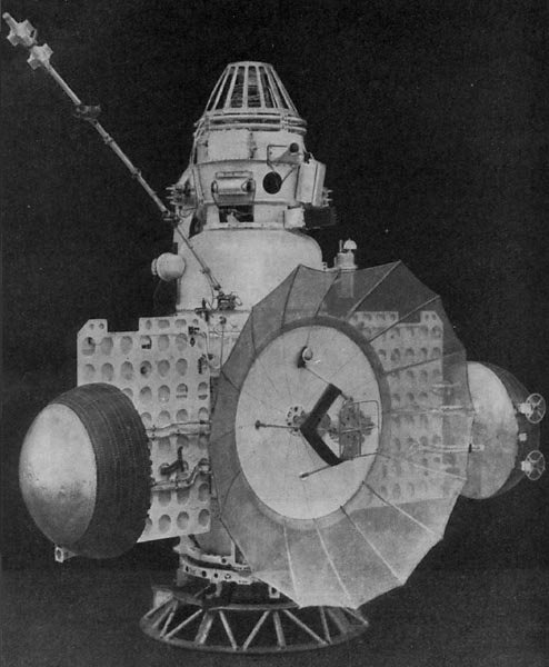
It would remain that way until 1965, when Soviet engineers sent another robotic spacecraft past the Moon. Zond 3, which may have been destined for Mars, flew by the Moon equipped with another film-based system, and captured a handful of images. To see more about the technical details of Zond 3 and its flight, you should check out Andrew LePage’s website. And once again, Don P. Mitchell has an incredible collection of Soviet lunar photographs.

undefined
Zond 2 – Zond 3 was part of the same series of spacecraft. From Wikimedia.

And, for the first time, we see Mare Orientale in its entirety:

Zond 3, Frame 3, the first full look at Mare Orientale, originally processed by Yu. N. Lipsky (1965). From Don P. Mitchell’s excellent website.

Here’s a reminder of where we are, to orient ourselves. Zond 3 is giving us a glimpse over the western limb, past Grimaldi:

Zond 3, frame 18. From Don P. Mitchell (seriously, go check out his website).

And once again, Lipsky went to work putting all this new data on the map. You should be able to see Crisium, Humboldtianum, and Grimaldi for reference. We can now see Orientale, Muscioviense, and Tsiolkovskiy in their proper positions. But notice, there are still blank spots on the map.

Then, in 1966 and 1967, NASA sent five robotic probes to the Moon: the Lunar Orbiters. The Eastman Kodak company adapted camera systems they had designed for the Air Force to the task of mapping the Moon in preparation for the Apollo program.7 The teams behind Lunar Orbiter took thousands of incredibly high resolution images of the lunar surface. The first several Lunar Orbiters were mainly used to scout out landing sites for Apollo on the near side. But even on Lunar Orbiter I, they managed to capture some images of the far side. One of them was this shot, with Tsilkovskiy sitting in the foreground of the first “Earthrise” image ever captured.

What made Lunar Orbiter distinct from the Soviet efforts was not only the number of images, but the level of detail that each image contained. Two lenses allowed the simultaneous capture of both medium-resolution and high resolution images, like this one showing the central peak of Tsiolkovsky and its inner walls.

On Lunar Orbiter IV and V, scientists got the opportunity to play a more direct role in target selection. In the shot below from Lunar Orbiter IV, you can see Grimaldi, and down there near the edge, coming into full view: Mare Orientale. Just a few shot later…

Mare Orientale.

Between all the Lunar Orbiters, we gained imagery of 99 percent of the lunar surface. This allowed cartographers to create a fully detailed map of the lunar far side.8

Apollo astronauts orbiting around the Moon would add to our imagery and understanding of the far side, as would more Soviet probes. Later robotic probes would fill in the few remaining gaps, which were mainly near the poles. Over those years, our knowledge and understanding of the lunar surface would only continue to grow. For centuries, the far side of the Moon had been one large blank spot on a map. Then, in less than ten years, largely due to the hard work of engineers and scientists working with robotic probes, we filled in blank spots. We have become more fully acquainted with our Moon, but we still have more to learn.

Special note for posterity:
This post was written the day before the crew of Artemis II flew around the Moon. One reason for the focus on Mare Orientale in this history is a quirk in the history of direct observation of the lunar far side by astronauts. On all the Apollo missions, their orbits and the lighting conditions never allowed them to view Mare Orientale under sunlight. The closest they got was an image of Orientale under Earthsine on Apollo 17. Tomorrow, people will see Mare Orientale in fully glory for the first time.

Mare Orientale in Earthshine on Apollo 17. From NASA/LPI.

Update 4/12/2026:
On Monday, April 6 – they did it.

“The Moon’s Great Scar,” from NASA.

  1. There are a lot of great histories of the early mapping of the Moon, but I won’t linger long on the details in this post. One of the most definitive is Ewen Whitaker’s Mapping and Naming of the Moon. There is also a good section on the topic in Mapping of the Moon: Past and Present by Zdeněk Kopal and Carder. Much of the information in this post comes from these sources. ↩︎
  2. Stephen Pumfrey argues Gilbert was definitively first: https://adsabs.harvard.edu/full/2011JHA….42..193P ↩︎
  3. Janet Vertesi takes a look at where Hevelius’ instruments fit into the technological culture of the time: https://www.jstor.org/stable/40731030 ↩︎
  4. The Linda Hall Library has a digital copy of Russell’s pamphlet, in which he describes the workings of the device: https://catalog.lindahall.org/permalink/01LINDAHALL_INST/1oon2h5/alma99455413405961 ↩︎
  5. Mare Orientale means “Eastern Sea,” which is confusing, considering it is on the western limb. The name was correct at the time Franz observed it–the directions changed in 1961. Ewen Whitaker and Richard Baum have a great history of Mare Orientale, which highlights the contributions of Russell, and explains the shift in directions. ↩︎
  6. See Boris Chertok’s Rockets and People, Volume II (PDF), translated by Asif Siddiqi. 519-538 ↩︎
  7. An older version of this article stated that the camera systems were designed for the CIA, but actually the ancestral tech of the LO cameras was originally designed for the Air Force as a part of WS-117L. Kodak camera systems in WS-117L did become a part of the CIA project CORONA. But the film readout system that was incorporated into Lunar Orbiter was a part of SAMOS (PDF), a separate component of WS-117L that was not transferred to the CIA. Both USAF and CIA satellite reconnaissance systems were soon were soon bundled into the organization that became the National Reconnaissance Office (NRO). The author caught this mistake on a re-read. ↩︎
  8. For more on Lunar Orbiter, you can find my master’s thesis on the about page, which focuses especially on the Kodak camera systems and the role of science in Lunar Orbiter. There is also NASA’s official history by Bruce Byers, and Farouk El-Baz’s The Moon as Viewed by Lunar Orbiter. The Lunar and Planetary Institute has an amazing page hosting images from Lunar Orbiter. ↩︎

History Highlights 5: Air Age Maps, Nukes in the Sky, and the Tao Te Ching

In Highlights, I share a collection of interesting history things I’ve come across recently. In this edition: an interesting map, an atmospheric nuclear detonation, and Ursula le Guin’s version of the Tao Te Ching.


I was recently gifted The Library of Lost Maps by James Cheshire. One of the maps he uses to introduce the book is this 1945 “Air Age Map of the World.” By the end of WWII, air travel was becoming more accessible, and the people who made maps like this were looking forward to widespread air travel in peace time. The map is centered on London, and uses a map projection that shows straight-line routes to major destinations.

The Air Age Map of the World (1945) by Edward Stanford Ltd. From Wikimedia.

It’s a great example of how modes of travel can literally reshape maps. The nice thing about planes is that you can fly straight from one city to another–but because the Earth is roughly spherical, that direct route appears curved on our usual map projections. Pilots use a technique called great-circle navigation to take the shortest route between two place (see the illustration below). “Air Age” maps often use an azimuthal equidistant projection, which shows the great circle routes as straight lines emanating from the center of the map.

This fantastic illustration by Bruce Morser is a great demonstration of great circle routes. Source: National Air and Space Museum, Smithsonian Institution.

The map reminds me of the Tabula Peutingeriana (TP), which shows the Roman road system. The TP is a medieval map that may have roots in classical sources. It’s shape was partly due to the technology it was produced with: parchment scrolls. But also, its aim wasn’t necessarily to produce an accurate physical description, but to show important sites in the empire and their connections with each other. This could aid the reader in imagining the relevant geography of the region. (More from Michael Rathmann: PDF).

One part of the TP, showing the tip of Italy and Sicily. From Wikimedia. If you’re interested, you should check out the whole image, which is quite large. It’s fun to explore.

These maps sacrifice geographic fidelity for the sake of displaying the relationship between places. In these cases, that relationship is defined by specific transportation technologies. The classic example of this that many people today are familiar with are subway maps.


In 1962, the United States detonated a thermonuclear warhead in the atmosphere above Hawaii. Part of a project called Starfish Prime, the detonation impacted communications on the ground and the telecommunications satellites in orbit at the time. It provided opportunities for scientists to study the effects (both at the time: PDF, and decades later), reaffirmed the dangers of testing nuclear weapons in the atmosphere, and preceded bans of atmospheric nuclear weapons testing.

A shot of the Starfish Prime test from a plane. From Wikimedia.

Finally, I’ve been reading a collection of poems by Ursula Le Guin. I was delighted to find that the collection includes her own rendition of the Tao Te Ching. She calls it a rendition, rather than a translation, since she wrote through comparing different English translations of the text, looking at differences in translation for specific characters. She used the Paul Carus translation as a “touchstone,” since it included details on each Chinese character used. Le Guin writes:


“If I could focus on which word the translators were interpreting, I could begin to understand why they made the choice they did. I could compare various interpretations and see why they varied so tremendously; could see how much explanation, sometimes how much bias, was included in the translation; could discover for myself that several English meanings might lead me back to the same Chinese word. And, finally, for all my ignorance of the language, I could gain an intuition of the style, the gait and cadence, of the original, necessary to my ear and conscience if I was to try to reproduce it in English.”

Ursula Le Guin, Collected Poems, Page 290

She compiled it over decades, eventually receiving support and guidance from Dr. J.P. Seaton, a professor and translator. Le Guin’s rendition is interesting to me not so much as an authoritative translation, but as a way to access the meaning Le Guin found in the text. That meaning, regardless of accuracy or connection to the original, was enormously influential on who she was as an author and as a human being. In that a way, it’s a bit like the maps at the beginning of this post. Reading it has been a way to ground myself lately. I wanted to end with a couple chapters that hit particularly hard:

30
Not Making War


A Taoist wouldn’t advise a ruler
to use force of arms for conquest;
that tactic backfires.

Where the army marched
grow thorns and thistles.
After the war
come the bad harvests.
Good leaders prosper, that’s all,
not presuming on victory.
They prosper without boasting,
or domineering, or arrogance,
prosper because they can’t help it,
prosper without violence.

Things flourish then perish.
Not the Way.
What’s not the Way
soon ends.

31
Against War


Even the best weapon
is an unhappy tool,
hateful to living things.
So the follower of the Way
stays away from it.

Weapons are unhappy tools,
not chosen by thoughtful people,
to be used only when there is no choice,
and with a calm, still mind,
without enjoyment.
To enjoy using weapons is to enjoy killing people,
and to enjoy killing people
is to lose your share in the common good.

It is right that the murder of many people
be mourned and lamented.
It is right that a victor in war
be received with funeral ceremonies.

History Highlights 3: Mapping the Ocean and the Moon, Living Museums, Ancient Arctic Voyages

Welcome to Inverting Vision, a blog about the history of exploration, science, and technology. From this point forward, I will be publishing posts every Thursday unless fate intervenes. History Highlights will appear occasionally as I work on more substantial posts. Next week I’m hoping to write about the scientific instruments that appear in Herbert Ponting’s photographs of the British Antarctic Expedition. Until next week, here are some highlights from my readings and the wider exploration and science community.

Do we know more about space than the deep sea?

Probably not these days, according to marine scientists Alan Jamieson, Premu Arasu, and Thomas Linley. In a fantastic article in The Conversation, they write that the truth of this notion depends on what comparisons you make. They explain that if you just consider the Moon, it may have been true during a small window in the 1950s and 1960s. In fact this may have been when the impression that we know more about space than the oceans originated. In those decades scientists were mapping the Moon more extensively, especially as NASA prepared for the Apollo landings. The Surveyor and Lunar Orbiter missions played a key role in this process, taking photographs of the lunar surface that were used by scientists and Apollo mission planners.

A photograph of the far side of the Moon from Lunar Orbiter 3. From NASA/LOIRP.

But this same period was very early in the history of fruitful deep sea oceanography. Echo sounding tech had only been in use for a few decades, and scientists were just starting to use echo sounding to map the seafloor (the first truly comprehensive map wasn’t published until Marie Tharp’s map in 1977). The authors of the article argue that since then, more robust exploration of the deep sea has produced a wealth of knowledge that probably surpasses our knowledge of the Moon and especially Mars. Go read their article to learn more.

A painting of Marie Tharp’s map by Heinrich C. Berann. From the Library of Congress.

In my experience, people casually referring to this idea often extend it to saying that we know more about “space” than the ocean. This must be even farther off the mark, even when you just consider objects in our solar system and disregard exoplanets. Europa and Enceladus may contain entire oceans that we know very little about. I’m looking forward to the launch of the Europa Clipper mission in 2024, which will hopefully bring us more information about Europa (although it won’t arrive at Jupiter until 2030).

Alvin and the Recovery of a Broken Arrow

Woods Hole tweets about the role DSV Alvin played in the 1966 recovery of a hydrogen bomb (referred to as a “broken arrow”) from the bottom of the Mediterranean.

Missions for the military were relatively common in the early days of deep-submergence vehicles, and especially for Alvin. The scientists were sometimes able to tack on scientific objectives to these missions, or military missions became a way to test or fund the development of vehicles and scientific projects. The relationship between the military and deep sea exploration will probably be a topic for a future blog post.

The Curious Life of the Vema

The Vema was an oceanographic research vessel that played a crucial role in the early mapping of the ocean floor and exploration of the Mid-Atlantic Ridge in the 1950s. Marie Tharp and her research partners used data from the Vema to create the seafloor map mentioned earlier. But that was only one small chapter in the life of the Vema. The sailing vessel was built in the 1920s for a wealthy American financier who used it as a yacht and hosted actors and celebrities. He sold the yacht to a Norwegian buyer who gave it the name Vema. Then the US military acquired the Vema in WWII and used for training. After the war the military discarded it, and eventually it was recovered and sold it to Columbia University, where it was used as a research vessel until the 1980s. Since then, it has been a chartered yacht for vacations in the Caribbean. Last year the yacht company announced they had new plans for the ship formerly known as Vema. They haven’t revealed what the new plans are.

The Vema being used as a training vessel in World War II. From Wikimedia.

Whales as Living Museums

Bathsheba Demuth writes about the role of whales in the history of Beringia in her book Floating Coast. She describes how bowhead whales were hunted by various groups throughout the history of the region. Sometimes the whales escaped these hunts with harpoons still buried in their bodies. Because bowhead whales can live for over 200 years, they sometimes collected a decent number of the tools used against them. Demuth describes a particular whale that carried “a museum of old weapons in his flesh.” These weapons ranged from ivory harpoons to explosive lance tips.

Ancient Voyage to the Arctic

It’s possible that in the 4th century BCE a Greek explorer named Pytheas ventured as far as the Arctic north of Europe, but later classical writers seriously doubted his claims. We know about him from later writers like Strabo and Polybius. In the Histories, Polybius recounts with skepticism Pytheas’ claim that in the far north “there [was] neither unmixed land or sea or air, but a kind of compound of all three (like the jelly-fish or Pulmo Marinus [sea lung]), in which earth and sea and everything else are held in suspense, and which forms a kind of connecting link to the whole, through which one can neither walk nor sail.”(Plb. 34.5) Voyages this far were rare for the Greeks, and Polybius was in part doubtful about how far Pytheas claimed to have sailed.

For more History Highlights from past weeks, click here. Follow the Inverting Vision Twitter account for updates on posts and other history of exploration and science content. Subscribe to get updates in your inbox: